⚡ Beta — early access open Real-time monitoring🤖 Personal AI agents🏛 Government integration

Less water, more yield — with artificial intelligence

Agro Flow AI is an integrated, AI-driven system for managing water use and irrigation. Sensors measure, the model calculates, and the field is watered in the optimal regime.

0+Farmers
0+Hectares
0+Stations

Live data from the platform — growing throughout the Beta program

LIVE METRICS LIVE
Soil moisture68%
Water flow18.6 m³/hour
Temperature28.4°C
ET₀ (evapotranspiration)5.2 mm/day
NDVI0.78
Data path

From a drop to a decision

The path of a single reading — from the field to your phone.

Sensors measure

IoT sensors continuously record soil moisture, water level, temperature and agroclimatic indicators.

01

Signal reaches the cloud

Even without internet access, data reaches the cloud securely and in real time over the radio network.

02

AI analyzes

Cloud AI models calculate the optimal irrigation regime, and CropAI forecasts the yield.

03
98%

The field manages itself

The recommendation reaches your phone — or the gate opens remotely and water flows to the right field on its own.

04
Who it's for

From the field to the republic — one platform

Data flows bottom-up: the farmer sees their field, the district sees its territory, the republic sees the whole network.

👨‍🌾

Farmers and clusters

Field level
  • Real-time field monitoring and mobile app
  • Recommendations from a personal agronomist agent
  • Remote irrigation control
🏢

District and regional organizations

Water and agriculture authorities
  • Control of water distribution across the territory
  • Centralized canal and gate management
  • Regional reports and alerts
🏛

Republic level

Ministries and agencies
  • Aggregated statistics across the entire network
  • Water resource balance and forecasts
  • Monitoring of state programs
🔗 Integration with government platforms
Ministry of Water Resources systemsMinistry of AgricultureE-government (my.gov.uz)Digital agriculture platformOpen API
What's different

The traditional way vs. AgroFlow AI

Traditional wayWith AgroFlow AI
Water useTraditional way: Guesswork, often over-wateringWith AgroFlow AI: Precise sensor-based calculation — 20-40% saved
Time spentTraditional way: Daily field walks, manual notesWith AgroFlow AI: Remote monitoring, automatic reports
YieldTraditional way: Decisions based on habit and guessworkWith AgroFlow AI: Data-driven decisions
Disease detectionTraditional way: Visual only — usually too lateWith AgroFlow AI: Early warning via an AI agent
ReportingTraditional way: On paper, scattered, hard to findWith AgroFlow AI: Automatic, in the cloud, always accessible
Monitoring frequencyTraditional way: Once a day or lessWith AgroFlow AI: Real-time, 24/7
System devices

Field infrastructure

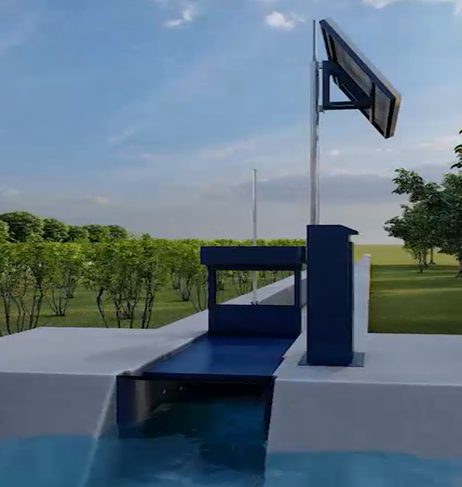
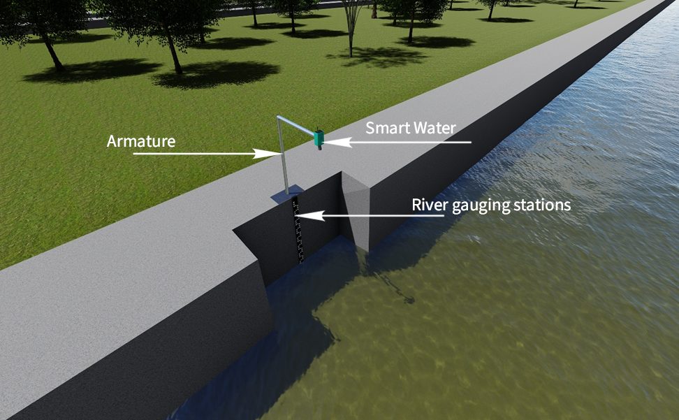
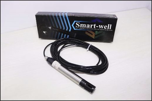
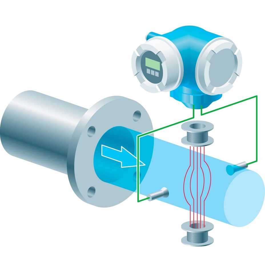
Sensors, weather stations and Smart Channel devices — all data flows into a single cloud platform.

All products →
Coverage

Across Uzbekistan

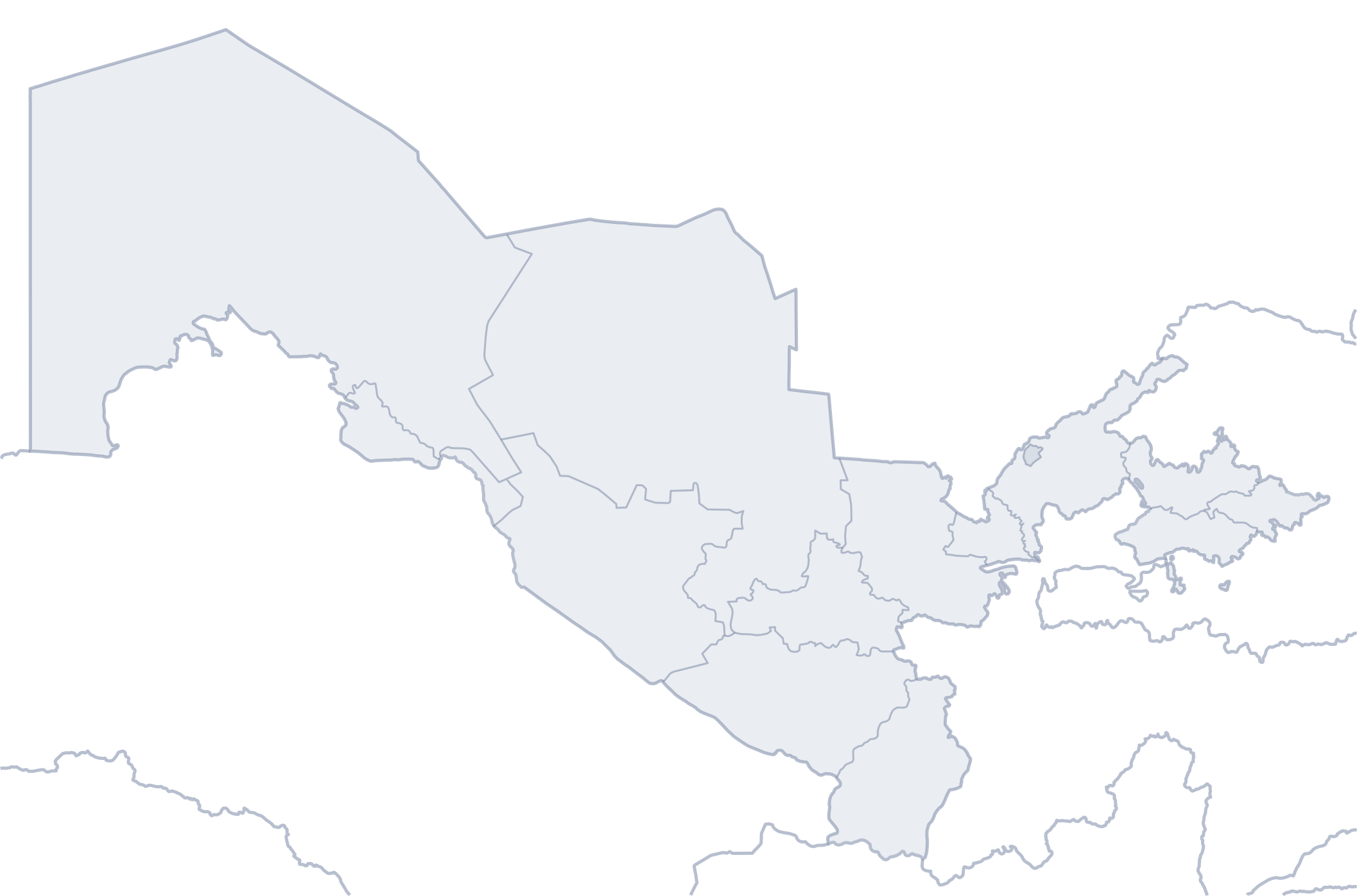
We remotely monitor farms and water facilities through our platform's stations — coverage is steadily expanding.

Map: Wikimedia Commons (NordNordWest / MacedonianBoy) — adapted under CC BY-SA 3.0

Technology core

The platform's intelligent engine

A mathematical water-balance model and integrated AI optimize irrigation decisions.

01

Integrated AI model

A single model that captures the relationship between soil moisture, water balance, evapotranspiration and yield.

02

Mathematical optimization

A water-balance mathematical model that optimizes irrigation decisions.

03

IoT + AI integration

IoT monitoring and the AI decision module combined into a single control system.

04

CropAI model

A dedicated model that forecasts yield based on local agrobiological factors.

Personal AI agents

A specialist for every user

The platform runs role-specific AI agents: an agronomist for farmers, an analyst for managers, a water engineer for engineers. Each one works with your field's own data.

🌱
Agronomist agent
online
Soil moisture on field A-17 dropped below 62%. I recommend irrigating tomorrow at 06:00 for 45 minutes.
for farmers and clusters
📊
Analyst agent
online
Water use fell 12% this week. Season yield forecast: 4.2 t/ha. Full report ready.
for managers and executives
💧
Water engineer agent
online
Canal K-3 level is 1.25 m, flow is normal. Scheduled gate #4 to open at 14:00.
for water management organizations
🚨
Dispatcher agent
online
Alert: strong wind (12 m/s) at station MS-003. Recommend postponing spraying.
for district and regional oversight
Platform interface

Control panel — live view

Field map, sensor status, and AI recommendations — all on one screen. Works on web and mobile.

dashboard.agroflow.uz
Soil moisture
68%
↑ optimal
Water level
1.25 m
→ stable
Water flow
18.6 m³/hour
↓ 12% saved
Temperature
28.4°C
ET₀ 5.2 mm/day
Field map · NDVI0.78
LowActive growth
Sensor statusLIVE
75%
18 / 24 online
4 optimal · 2 warnings
Alerts2
Field B-3: moisture at 22% — irrigation time approaching
MS-003: high temperature (32.8°C)
💧
Optimal irrigation regime ready
Recommendation: 42 mm of water · next irrigation in 2 days 11 hours
Apply regime
Free tool · Knowledge base

Crop, soil and hydromodule data

The platform accounts for each field's crop type, soil, and hydromodule zone — automatically calculating the irrigation rate and water fee.

🧮

Irrigation rate & water fee calculator

✓ Free
Results

Impact in numbers

20–40%
💧 Water use decreases
through an optimal irrigation regime
10–25%
🌱 Yield increases
through science-based decisions
30–50%
👷 Labor costs decrease
as a result of automation
📡 Irrigation is controlled remotely and automatically🛡 Fewer human-factor errors

* These figures are a forecast based on scientific modeling and experience from similar systems. Real results will be confirmed during the pilot program.

Pilot program result
100%68%Water use
baseline+18%Yield
100%60%Field-check time
Pilot project

One field — one season

I used to judge irrigation by eye. Now I see every field's status on my phone — I know exactly when and how much water it needs.
AT
Aziz T.
Tashkent Region, farmer

* This is a pilot-project result, honestly labeled as such — not yet large-scale, independently verified statistics. Real customer case studies will be added as the pilot program grows.

What pilot participants say

Hear from those who've seen results in the field

★★★★★
I used to irrigate by guesswork. Now the platform tells me itself — which field, when, and how much.
AK
Alisher Karimov
Cotton · 52 ha · Andijan
★★★★★
We caught tomato disease at an early stage. Last year that same disease wiped out half our harvest.
DT
Dilnoza To'rayeva
Greenhouse · 8 ha · Samarkand
★★★★★
We monitor every field from one screen. We only go out when there's an alert — saves time and fuel.
BR
Bobur Rahimov
Agro-cluster · 640 ha · Bukhara

Share your feedback

If the platform helped you see real results, your feedback will be useful to other farmers. Submitted reviews are published after moderation.

Your feedback won't appear on the site immediately — it will be published after moderation.
Pricing

Choose the plan that fits you

Satellite data and the free calculator are included in every plan.

Free

For small farmers

0UZS
  • Satellite data (NDVI, EVI)
  • Weather forecast
  • Irrigation rate calculator
  • 1 farm, 5 fields
Request the free plan
Popular

Premium

Full control with IoT and AI

500 000UZS / mo
  • Everything in Free
  • IoT sensors (leased)
  • AI agents and recommendations
  • Real-time monitoring
  • Unlimited farms and fields
Contact us

Enterprise

For large organizations

Custom contract
  • Everything in Premium
  • Custom integration and API
  • Dedicated account manager
  • SLA guarantee
Contact us

IoT sensors — for lease

No upfront cost, monthly lease.

  • AgroSoil — soil moisture, pH, NPK50 000 UZS/mo
  • Smart Channel — water flow and level150 000 UZS/mo
  • Smart Water — water volume and pressure100 000 UZS/mo
Partner ecosystem

Who we work with

🏛
Water management organizations
🎓
Research institutes
📡
IoT manufacturers
🛰
Copernicus / Sentinel-2
🏢
Agricultural clusters

We're open to partnerships.

🚀 Beta program — free early access

News & blog

Project news and practical advice

Platform development, technology news, and practical agro-advice for farmers.

All articles →
FAQ

Frequently asked questions

Does the system work in areas without internet?
Yes. Sensors transmit data over a radio channel (LoRa) — a technology that doesn't depend on internet access and works up to 10 km away. Data reaches the cloud through the nearest base station.
Who installs and configures the devices?
Installation is carried out by platform specialists — usually one day is enough for a single field. Setup, calibration and technical support are included in the service. All we need from you is the field boundaries.
Who can see my field's data?
Field-level data belongs to you alone. District and regional organizations only see aggregated statistics — individual farm data is never shared without your consent.
How do the AI agents work?
Each user is assigned an agent matching their role: an agronomist for farmers, a water engineer and analyst for organizations. The agent gives plain-language recommendations based on your field's data and answers your questions.
How does integration with government systems work?
The platform provides an open API — data exchange with the ministries of water resources and agriculture, and e-government platforms, happens over standard protocols.
How do I get started? What does it cost?
Leave a request in the form below — we'll get in touch within 24 hours, learn about your needs and propose pilot program terms. During the pilot phase, terms are agreed individually with each farm and organization.

Join the pilot program

Be among the first users — let's start digitizing your field today.

We'll respond within 24 hoursFree consultation and field analysisFor farmers, clusters and government organizations

📩 Leave a request

Your data will not be shared with third parties
✈️ Telegram📞 +998 55 506 00 64